
THE SOUTHWEST
 We headed out of California in steadily rising temperatures, taking I-5, the fastest way we could go. A thermometer we passed in Baker read 115 degrees. We dared not stop for lunch, it was so hot without the air conditioner we decided we'd rather starve than bake there in the desert oven. We had a choice of staying the night in Las vegas or Lake Mead and really, the choice was easy, considering the dogs, the heat, and our desire for some natural beauty. After stocking up at the Wild Oats store in Henderson we found a place to camp on the shores of Lake Mead.
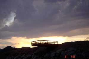
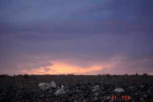
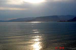
It was still hot and no were dogs allowed at the beach so we had to become stealth dog-people. Like many other swimming-dog owners we've met, we headed for an inlet of the lake that was hidden from view and all of us (even Bubbo, the water-hater) dove in. Well, actually, Bubbo was "coaxed" in but seemed happy for it afterwards. The 83 degree water felt deliciously cool compared to the air temperature, so we swam and played and Ziggy got a friendly man with a dog to throw sticks for her. Soon dusk colored the sky, wild winds began to blow and lightning danced over the hills. It rained in the distance and later on us, but we still ran the air conditioner all night and slept without covers. Although the scenery was stunning, Rus was perspiring with gratitude that our lives hadn't led us to settle there.
 |
 |
 |
THE GRAND CANYON
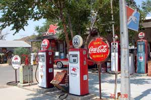 On our way to the South Rim of the Grand Canyon, we took a 90-mile stretch of the old Route 66 from Kingman to Seligman, Arizona, which parallels the old Santa Fe railway, winding through breathtaking country, hardly another soul on the road. Route 66, though mostly bypassed or assimilated, has an almost mythical status in the American psyche, and local businesses along the route are quick to capitalize on whatever association or proximity they may have to it.
We felt lucky to find a spot in a pretty little campground only about a mile from the Grand Canyon called Ten X. The Ponderosa Pine forest was still moist from a recent rain and the high mountain air smelled fresh and clean. After our evening walk we headed to bed, intending to see the Grand Canyon early the next morning, before the crowds descended.
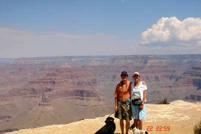
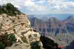
The Grand Canyon is something you just have to see for yourself. Millions of people have (some of those millions were there on the same day we were!), and billions of words have been written about it, but the Canyon is just too much to describe. You can't take a photograph of it, either, for the same reason. If you haven't been, try finding a place on the rim where you can be by yourself for a while, where there's no concrete pathways, no guardrails, no interpretive plaques, and just sit.
Kathleen was disappointed to see that the air quality in the Canyon was very poor due to nearby forest fires (and pollution from LA), so catching the depth and beauty of the canyon by camera was difficult to impossible. We bought postcards, and she kept trying anyway.
 |
 |
 |
 |
 |
 |
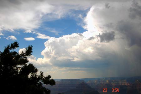 We had to see the North Rim, too; with Kathleen, you have to see everything. The drive took us higher and higher on the Kaibab Plateau through large stands of Ponderosa pines, giving way to spruce and fir, then groves of aspen around 8,000 feet, broken by miles-long grassy meadows dotted with sink-hole ponds (collapsed voids in the limestone subsurface created by water erosion), flocks of wild turkeys, and deer. Even without the North Rim, the drive alone is its own reward.
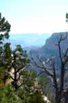
But the Rim was there, even grander for Rus because it allowed a more personal experience, and for Kathleen, another perspective of the same grand, heart-and mouth-opening miracle. Yes, it's the same canyon, but from a shaded, cooler, forested area, with far fewer people, more secluded vantage points, and a huge old rustic lodge perched right on the canyon rim. While taking turns letting each other go down a precipitous"no dogs allowed" trail to an overlook, we met another couple doing the same thing, Mary Lee and Ray from Columbus, Ohio. They were so lively and interesting, the four of us just stood there for hours talking, almost oblivious to the grandeur of our surroundings.
GRAND STAIRCASE-ESCALANTE NATIONAL MONUMENT
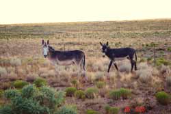 Isn't "escalante" Spanish for staircase? Oh well, we're just glad it's there, even if it means Staircase-Staircase. It's been nearly 10 years since President Clinton signed the bill creating this huge public area, and local residents may finally be realizing there's a lot more money and jobs in tourism than in resource extraction. At the time, though, if I remember correctly, there was so much bitterness among the locals that the signing was done for security reasons at the Grand Canyon instead of Escalante.
We'd done some hiking in this area before it became a National Monument, followed a canyon all the way from the rim down to the Escalante River, explored side canyons, climbed up to see Anasazi ruins and pictographs, and generally had a fantastic time. Though I'm glad to see this area protected, there is a downside to it: publicity. The canyon we hiked is now a popular destination, with guided trips, postcards, the works.
Dropping down into Lake Powell, we again searched for and found a cove protected from the dog police, and gave Z and B and ourselves a good swim at Lone Rock, again in the good company of other dog owners. The water is a clear aqua blue and the perfect temperature on a hot day. Lake Powell is 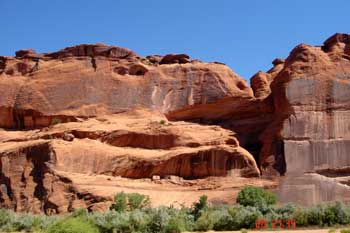 what we have now instead of the Colorado River's Glen Canyon, and after seeing it, it's hard to imagine how the campaign to remove the dam could ever be successful. Like Barry Goldwater said, "We may have lost a river, but we have a lake like no other in the world". In terms of recreation alone, the number of people using Lake Powell must be hundreds of times the number who would ever hike or raft down Glen Canyon.
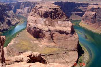
Leaving Page, Arizona, the town created by the construction of Glen Canyon Dam in the late '50s-early '60's, we stopped at a sign that said "Horseshoe Bend Trail-3/4 Mile", and saw some people just returning to their car who looked like they'd hiked a lot more than 3/4 mile. Red-faced and sweating, they said it was well worth it, but to take water. To distract ourselves from the oppressive mid-day heat, we skipped along singing all the sea shanties we knew, finally arriving to see the Colorado hundreds of feet below the shear rock rim, clear emerald green, flowing in a perfect horseshoe bend around a red sandstone plateau, a view so precipitous it makes your feet and butt tingle, and so vast you can't look at it all at once, much less photograph it. Ziggy, oblivious to heights, trotted right up to the rim to investigate, scaring the _____ out of us, so we made the dogs lie in the shade of a sagebrush, and they actually did!
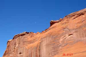
Can you see the Dragon in the Rock? It's at Canyon de Chelley.
 It's worth noting that we were the only Americans among several carloads of people making the hike to Horseshoe Bend that hot afternoon. In a good number of the places we've visited, especially those that are more difficult to access, Americans are in a distinct minority. We've noticed that the Europeans, who've been mostly French, Germans, Dutch and Eastern Europeans, seem to be in pretty good physical shape compared to the Americans. Their currency, the Euro, is also in good shape relative to the dollar, and maybe both those factors explain the numbers that we've seen. Rus asked a French guy at Mesa Verde if there was a tour group there from France, and he said no, that he himself was amazed to see so many of his countrymen there! At any rate, we're glad to see that the Europeans don't hold America (the land and its people) responsible for the arrogant behavior of our current Administration.
CANYON DE CHELLY
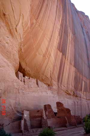
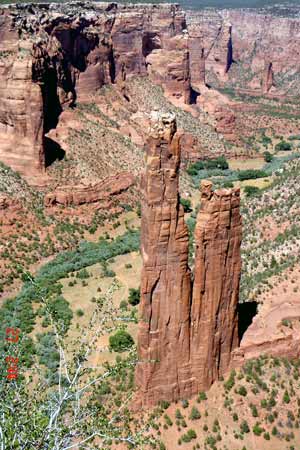
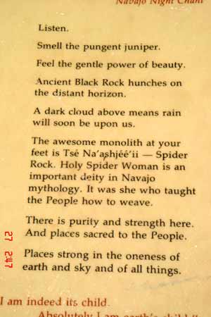
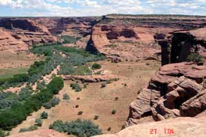
On to Canyon de Chelly, which is part of the huge Navajo Reservation, but managed by the Park Service. Being totally ignorant, I assumed it was a French name, but it turns out it's a Castillian bastardization of the Navajo word tsegi, which means something like "place of the rocks". We just had to go see it, and decided to hire a guide with his own 4wd vehicle for a private tour--you can't explore the canyon without a Navajo guide, which is good because they love and respect their land and are able to make a living teaching people like us about it. The Motel where we met our guide gave us an electrical outlet so we could leave the AC on in the rig for the dogs, as the temperature was in the 90's.
 |
 |
 |
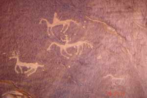
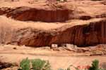
Our guide, Dez, grew up in the canyon, and his parents still live there some of the year. In fact about 30 families still have use rights on ancestral plots of land in the canyon, which they use for grazing livestock and growing maize, neither of which looked too profitable to us. We saw several of the Anasazi ruins, which Des pronounced "riuns", including the famous White House, which had Anglo graffiti all over it from the 1870's to the 1920's (seen with binoculars). All the accessible ruins are fenced off to prevent any further destruction. I asked Dez if he thought there would be tours of the ruins of New York City a thousand years from now. He laughed, and said to himself, "the New York Riuns.....".
 |
 |
 |
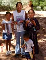 Never having been around Navajo people, we were as interested in them and their present culture as we were in the Anasazi who preceded them. Around the Four Corners area, the Navajo are not only the predominant tribe, but the predominant population as well, and have been for several centuries. Their culture runs deep, their language is a living tongue which they speak among themselves, and their spiritual life is rich and active, although some have adopted the Christian religion. Being on Navajo land is truly like being in a foreign country. Even the ubiquitous American flags and Support Our Troops ribbons are noticeably absent in Navajo country.
After our tour, we drove the rim of the canyon to see from the top what we'd seen from the bottom, and were amazed to find many more Anasazi ruins tucked into overhangs high on the canyon walls, much closer to the rim than to the canyon floor. They looked to us like swallows' nests, seeming inaccessible except by air.
SAN JUAN RIVER
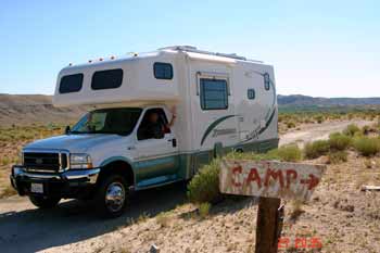 Driving east on Hwy 160, just past the Four Corners Monument, we came to the San Juan River, muddy but very inviting after being around so much heat and parched land. We spotted a faded, hand-painted sign pointing up the hill which said "CAMP", so we turned off, following the dirt track a mile up the hill to a house. Nearby were two or three parking places where the land had long ago been leveled, now covered with sagebrush, with some collapsed plywood structures probably intended for shade. We had arrived! There was a boy out in the yard who waved to us. We went over to him and explained that we wanted to camp by the river, not on the "developed" site, and he said that would be ok, and the fee was $10. We made him promise to give it to his family and to tell them that we were down there, as we didn't want any trouble on Navajo land, then put our rig in 4wd and made our way slowly down a bad road to the river, where we found a level spot with a fine view right on the bank.
Just settling in to camp for the night, sipping a beer, throwing sticks in the river for Ziggy, we were alone for about 10 minutes when two trucks pulled up about 50 yards away and a bunch of people got out to go fishing. They left us alone, setting up about 100 feet from us, an old man, a woman, 6 medium-sized kids, and a few teenagers. After a few minutes, the man hollered over to us with his hands spread that the kids were after a big fish, and Kathleen hollered back what kind of fish. Well, if you fish yourself, you must know that, next to the weather, the subject of fishing is probably the lowest common denominator of human conversation, so we began joking about Navajo fish, Hopi fish, etc. His name was Tet-Tom. He claimed to be the grandfather of all the kids, and without knowing we only had one left, asked if he might have a beer, which of course we gave him. He read the Anchor Steam label and laughed at the idea of drinking beer from San Francisco, which he had never done before. One of the teenagers showed us a piece of fruit they'd brought along but they didn't know what it was. Kathleen told them it was called a papaya, and was delicious, especially with lime. They said they didn't have a lime, so Kathleen gave them one of ours, and they gave us half their papaya. It was indeed delicious, and offset the loss of our last beer. Tet-Tom may have had a few before coming to the river, because he was pretty gregarious, a trait which the Navajo are not known for. Kathleen asked him if he was a Navajo, and he said half Navajo, half Apache, half Ute......"and half crazy!", the boy with the papaya piped in, obviously used to kidding the old man.
We had fun talking to Tet-Tom and Papaya Boy, watching the other kids fish. The kids were down a ways from us, fishing off a large slab of sandstone, but had incredibly keen hearing and were listening to us intently, for whenever one of us said something they thought was funny, they'd all turn around and giggle. They had only one pole for all of them, and when the oldest girl got a catfish on the line she yelled for help and all the other kids grabbed parts of the pole and even the line itself to help land that 12" monster, yelling and screaming the whole time, then they all ran back to the truck with it. I don't think I've ever seen so many kids have so much fun with so little gear. The rest of the party left soon thereafter, but they stayed for a while where they'd parked and built a big fire, presumably to cook the catfish, and we were left to ourselves, the river, and a huge night sky with the entire constellation Scorpio in view.
MESA VERDE
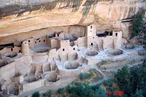 Next day, we lounged around this perfect campsite until late morning and then, not yet sick of Anasazi ruins, headed out for Mesa Verde. Entering Cortez, Colorado, we saw a pawn shop which didn't look like a tourist store, so pulled in to take a look. It was run by a 22-year-old man whose grandfather had started the business long ago. We plied him with questions about his business and about the customers, and the young man, Robin, turned out to be very knowledgeable about his business, and especially so about his customers, over 80% of whom were Indian. He was very familiar with all the tribes in the Four Corners area, their history, their customs and their relationships with one another, which was all fascinating to us. Luckily, at least for us, no other customers were in the store during the hour we were there, so we had plenty of time to talk. We ended up buying a nice Navajo rug, and who knows where we'll put it.
Mesa Verde is the ultimate destination to see Anasazi ruins and to learn about the people who built them. First of all, the Anasazi didn't die out; they just packed up and left, and their descendants are still going about their business today, mostly among the Hopi, but also among several other tribes still the Four Corners area. In all, about 24 tribes claim some ancestral link to the Anasazi. Anasazi is a Navajo word meaning "unknown people", or even "enemy" depending on who you talk to, so it's understandable that their many living descendants would take umbrage at their forebears being called unknowns, or worse, in another tribe's tongue. To remedy the situation, a more politically correct name is coming into use to describe this ancient people: Ancestral Puebloans. It may not roll off the tongue as easily as Anasazi, but it more accurately describes who they were. No one seems to mind that the name Ancestral Puebloans is also in a foreign language.
 At t
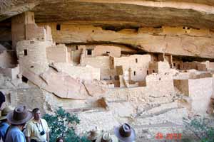
At t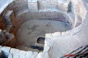 he base of the Mesa, you go through the park entrance, then drive 15 miles up to the top, over 8000 ft. elevation. Then on to the visitors center, where you must choose which of several tours you want, at what times, and buy tickets. Then you gather with 40 or 50 others at the assembly area, the ranger gives an orientation talk about how strenuous the tour is, what your fitness level should be to accomplish it, the possible consequences of an accident or medical emergency, a history of recent mishaps, and you're off to see the ruins! In spite of everything, it was well worth it, to see these beautifully made buildings of sandstone, mud and poles, all constructed during the last 100 years that they lived on these lands, then just left with whatever they could carry, leaving behind clothing, household items, food stores, and lots of other stuff which future archaeologists were happy to discover and puzzle over. I don't think we could leave our own homes untouched for 800 years and find anything still standing, though lots of our plastic consumer goods would still be identifiable in the rubble, and that package of hot dogs would probably still be fine!
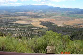
< View from Mesa Verde
Finally having seen enough ruins, we beat it down the Mesa to Durango, Colorado, thankful to see the lush green valleys after weeks of desert. In town we visited the Visitors Center (what else are you gonna do at a visitors center?), and got information on "dispersed camping sites" from a guy at the counter. These are sites on public lands outside developed campgrounds where you can camp for free in a more natural  setting. He directed us to a Forest Service road off Highway 550 that had some good ones. We wanted to just sit for a couple of days, relax, do some work on the rig and give Kathleen some time to work on the website, and a nice camp by a stream with a view of the mountains sounded like just the ticket. We drove up one of these roads, 4-wheel drive all the way, over large, sharp rocks and sharper turns, about an hour to go three miles, and there at the end we found a lovely lake nestled in a meadow, wildflowers all around, the perfect place. The only thing was, there were people everywhere, and so many cars that we couldn't have found a place to park even if we'd wanted to! It was tough just finding a place to turn around. We ended up in the overflow parking lot of a Forest Service campground for the night. Next day we tried our luck again, along another remote road with majestic views and lovely campsites, every one occupied, and spent that night off the dirt road, flies drawn to our camp by the cow pies all around us, pickups and ATVs cruising by every few minutes, kicking up dust. We learned that Coloradans love the same kind of places we do, but they get there earlier and stay longer.
Continuing up Hwy 550, we passed through the old mining towns of Silverton and Ouray, set in deep valleys reminiscent of the Swiss Alps. The mines are abandoned, but the towns are extracting a far richer ore, from the wallets of hordes of visitors wandering up and down the streets. We landed in Montrose for that night, and the next, at a lovely park outside of town, the Incomparable River rushing by a few feet outside our door.
Travel Log, Past Entries: Click to read each one
Oregon, Washington June 2005
California July 2005
Southwest July/August 2005